Blog Archive
What Lies Beneath: A History of Collect Pond
Share
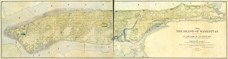
A rendering of what the island of Manhattan looked like in 1609. Image courtesy of the New York Public Library.
Apocalyptic movies (and a few more scholarly sources) suggest that New York’s future may be under water. But there is more poetic justice in this end than you might think, considering New York’s past was also submarine. Before there were skyscrapers and taxicabs, New York City was made up of lush vegetation fed by a large network of waterways. When the Dutch joined the Lenape on the island in the 1600s, there were more than two dozen streams and four dozen ponds in Manhattan. Early residents would tap into those water sources through privately-owned wells that would provide fresh water for drinking.
As the city’s population grew, the government constructed the first reservoir downtown where Broadway and Pearl Street currently stand today. During the Revolutionary War, water from the reservoir and from Collect Pond, which was located in what is today Chinatown, was distributed to most of the city’s 22,000 residents through hollowed out logs. “Collect” originated from the Dutch word “Kolch,” meaning “small body of water.”
Residents would spend time by the pond, picnicking in the summers and ice skating in the winter. This idyllic scene did not last long though, as the rise of industry started to affect New York City’s natural resource; the neighboring slaughterhouses, tanneries, breweries and other local shops began dumping their waste into Collect Pond. By 1800, the Pond was completely polluted, spreading cholera and other diseases to the city’s residents.
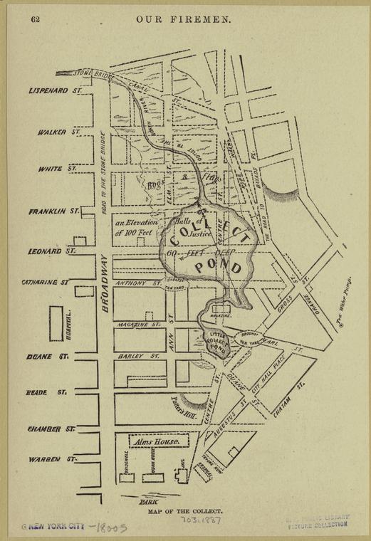
An 1887 map depicting Collect Pond. Image courtesy of the NYPL.
Eventually, city leaders decided to drain the water and backfill the pond with debris, dirt and trash. Because the land surrounding Collect Pond was marshy, in 1807 the city started construction on a canal that would drain the polluted water into the Hudson River. The water was eventually drained in 1811, but New Yorkers complained about the smells emanating from the canal. Workers began to cover the canal, and in 1821, they completed a 100-foot wide street surrounded by trees, and Canal Street was born.
This newly constructed land was owned by rich businessmen, who capitalized on this opportunity to build brand new apartments over the former pond. The area was dubbed Paradise Square, though over time, it failed to live up to its name. Built over marshland and landfill, Paradise Square began to sink and the foul odors from the canal began to rise to the surface. Affluent residents moved out, opening up housing for poorer residents, who at the time, were comprised of the newly arriving immigrants. As the area fell more and more into neglect, what was once Paradise Square became known as the Five Points, one of the most well-known immigrant slums in the city.
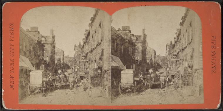
An early photograph of the neighborhood known as Five Points taken in 1875. Image courtesy of the NYPL.
The city eventually turned to reservoirs farther north; in what today is Westchester County and the Catskills region. Yet, evidence of these early waterways still exists in some shape or form underneath tons of concrete and steel. Basements and sub-cellars around the city flood with water from these underground springs, providing a constant reminder of New York’s past landscape and revealing the layers of a constantly changing metropolis.
–Posted by Tricia Kang, Marketing Manager